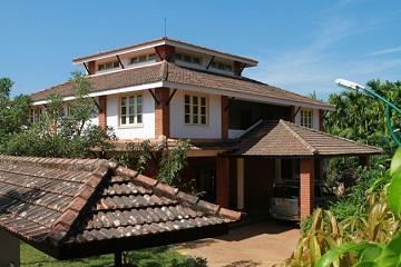
Evergreen thickets, captivating views of hills and valleys, cascades plummeting from rocks, small stretches of peeping backwaters, several swift streams rushing to join the river Sharavathy, an assortment of diverse flora and fauna, ancient fort ruins remnant of past glory, beautiful Jain temples, scattered hamlets, terraced fields in perfect arrangement, quaint houses with tiled-roof, the Sharavathy Valley promises a mixed bag of nature, adventure, history and culture.
Located on the evergreen slope of the Western Ghats, the Sharavathy Valley is loaded with all the ingredients for an ideal outdoor holiday. Moderately undulated, the area has patchy tropical jungle interspersed with acacia plantations (part of a 1970's afforestation plan by the forest department). Hamlets dot the valleys with Deewaru (an indigenous community) and Jain communities comprising of the ethnic majority. While the forests and the hills infuse the wilderness, the red roofed homes and the terraced paddy fields further domesticate the landscapes. The wilderness here seems to have engulfed the history of the place, literally.
Kanoor Kote hike: an ancient military fort of the Pepper queen (Rani Channabhairadevi), Kanoor Kote is steeped in mystery. Approachable from many directions, the terrain in moderately undulated with some steep uphill and down hills sections. However the trail is well defined and more for most parts a narrow mud road. The final section near the fort entrance is wild and untouched. Inside the fort, tropical vegetation has claimed most part of the ruins. The secret tunnels, many wells, living areas, the temple perched on a high ground and an old pond are among the attractions within the fort.
- Outdoor time: 2 days
- Degree of difficulty: Easy
- Accommodation: in tents or rural home
- Nature's Call: outdoors
- Food: simple vegetarian; choice between local hospitality and camp food
- Best time - October to January
Ghats to Sea Hikes: Stepping forth on the rugged hill slopes of the Western Ghats, on the Govardhanagiri range, this hike meanders through the hill range as it attempts to descend to the coast. Interspersed with dense forests, hobnobbing with remote hamlets, meeting large-hearted people, Ghats to Sea hikes provide a scintillating exposure to the sea facing slopes of the Western Ghats. They usually begin in the hills and descend considerably by the end of the hike, aiming to end on a beach. The last portion is typically a boat ride/jeep ride to the beach. Currently three different Ghats to Sea trails are on offer.
- Outdoor Time: ideally three days, but even two days will do
- Difficulty: Moderate - involves 4-6 hours of hiking per day covering a total distance of 15-20 kms over a span of two/three days.
- Accommodation: in tents or rural homes
- Nature's call: outdoors
- Food: vegetarian; choice between local hospitality and camp food
- Pick up point for all hikes: Sagar private bus stand
- Best time: all year round
Beach hike: On the west coast along the Arabian Sea, the hike offers an interesting perspective into coastal life, livelihood and culture. Marvel at vast expanse of sea, peep into fishing villages, hop across little streams, gape into large rivers joining the sea, balance on wooden canoe (fishermen's boat) to cross the gigantic rivers, walk past the high cliffs, tread carefully on narrow trails perched on treacherous hill slopes diving into the sea, relax at lonely beaches, eat fish curry to your heart's content! The hike from Honnavar to Gokarna is an idyllic walk by the sea. The hike ends at the temple town of Gokarna. The Gokarna beach offers one of the best sunsets along the west coast.
- Outdoor time: 2 to 3 days
- Difficulty: Moderate (during summer, the sun is an added challenge)
- Accommodation: tents and fishermen homes
- Food: camp food, excepting one meal with a fisherman family
- Nature's call: outdoors
- Best time: October to January
Waterfall hikes: The Western Ghats are studded with cascading streams and rivers. Shimoga and North Canara districts in Karnataka are home to many picturesque waterfalls that are tucked in the vast expanse of tropical forests. Burde Jog, Dabbe, Goodana Gundi, Gudli Gundi falls are some of the little-known off the tourist circuit waterfalls that one can hike to. All of these falls are not accessible by road. They involve a short hike from the nearest mud road.
- Outdoor time: 1 or 2 days
- Difficulty: moderate (often involves challenging terrain as you near the waterfall)
- Accommodation: tents or rural homes
- Food: camp food
- Nature's call: outdoors
- Best time: June to December
Located in the central portion of the Western Ghats in Karnataka, most of these hikes are based in and around the Sharavathy valley. The main start point for all hikes except (the beach hike which starts from Honnavar on the coast) are Sagar town.
Getting there:
By Road: From Bangalore, the ideal route to Sagar is via Shimoga (270kms). From Shimoga drive to Sagar (75kms). Our trip leader will reach you at Sagar and guide you further on.
There are direct KSRTC luxury, deluxe (Rajahamsa) and even Airavata buses from Bangalore. There are also comfortable non-AC overnight sleeper buses, run by KSRTC, Sea Bird, Gajanana, Kamat etc. All buses going towards Gokarna, Karwar, Honnavar, Sirsi, Jog, Bhatkal pass via Sagar town.
By Rail: Nearest Railway Stations: Sagar, Talguppa (22km); Honnavar (70 km - on Mumbai to Mangalore - Konkan line), Shimoga (98 km), Birur junction (118kms on Bangalore - Pune main line). There are daily trains from Bangalore to Shimoga. The Talaguppa - Shimoga line has been temporarily shut for conversion to broad gauge. The overnight train to Shimoga is a convenient alternative. From Shimoga, there are local buses to Sagar or you could hire a taxi to Sagar. For those heading from Mumbai, Mumbai - Birur is a good option. From Birur it is a 2 and half hour drive. You could also come down Konkan route to Honnavar. From Honnavar it is an hour and a half drive up the Ghats.
By Air: Nearest Airport - Hubli (110 km) Mangalore (200 km)